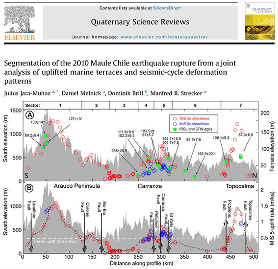
Mapping marine terraces in Central Chile
Friday 25 December 2015 kl. 07:21
TerraceM has been used to map marine terraces along the coast of Central Chile (600 km) using LiDAR topography, determining patterns of surface deformation such as long wavelenght deformation associated to deep sources such as the interplate, and short wavelenght patterns associated to shallow sources such as faults located in the upper plate.