Search
Feeds
Archives
About
Links
Mapping marine terraces in Central Chile
Friday 25 December 2015 at 07:21 am.TerraceM has been used to map marine terraces along the coast of Central Chile (600 km) using LiDAR topography, determining patterns of surface deformation such as long wavelenght deformation associated to deep sources such as the interplate, and short wavelenght patterns associated to shallow sources such as faults located in the upper plate.
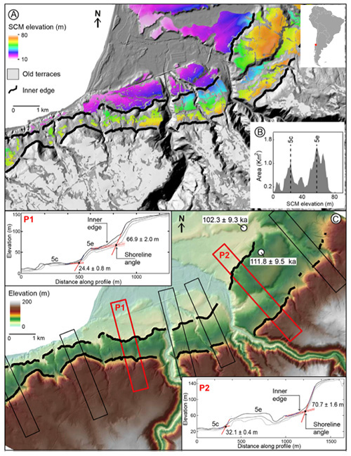
Example of staircase terrace analysis in Pelluhue, Chile (Jara-Muñoz et al., 2015. Quaternary Science Reviews). Upper image is a Surface Classification Model (SCM), the lower image display the location of swath profiles. Both mapping methods are included in TerraceM Maptools.
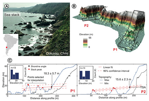
Example of rough coasts analysis in Coliumo, Chile (Jara-Muñoz et al., 2015. Quaternary Science Reviews. U. Potsdam).