Sunday 05 April 2026 kl. 07:30
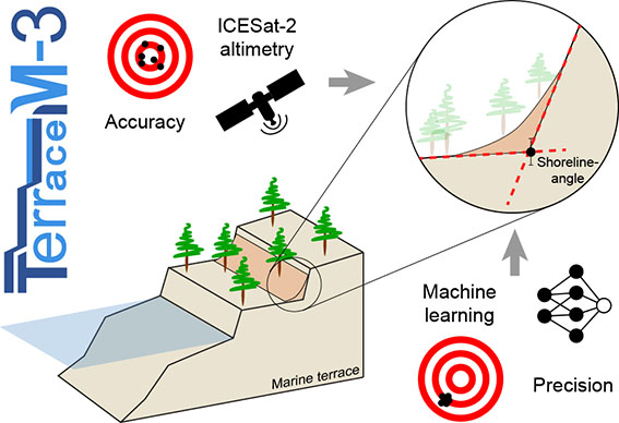
The new TerraceM-3 includes machine learning mapping and ICESat-2 download processing and analysis functionalities to extend marine terrace mapping everywhere
Download here, the latest TerraceM-3 version
Thursday 23 November 2023 kl. 18:55
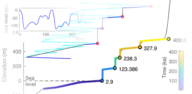
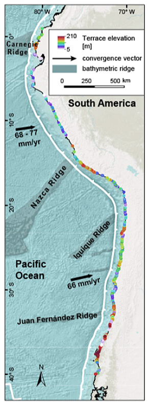
Roland Freisleben has presented a monumental marine terrace mapping along the western coast of southamerica along 6.000 kms. This titanic progress was done using TerraceM-2 and Tandem-X topography. The marine terraces of the las interglacial (MIS 5e, 125 ka) are present almost continously along the coast and in most cases carved in bedrock. The systematic mapping by Freisleben et al. (2021) provides for first time an almost continous assesment of vertical deformation rates since 125 ka. Using statistical methods and wave theory he disentangled the frequency and amplitude of permanent deformation patters along the coast, this allowed to discriminate between the wavelenght of different deformation mechanisms and their role in tectonic uplift distribution and megaearthquake segmentation (Freisleben et al. 2023).
Friday 19 August 2022 kl. 19:24
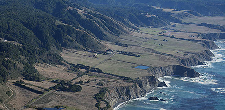
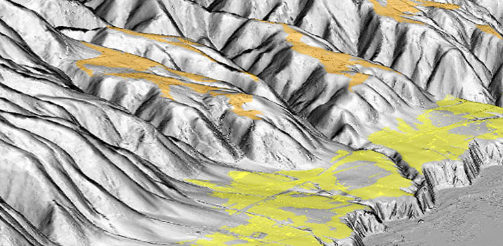
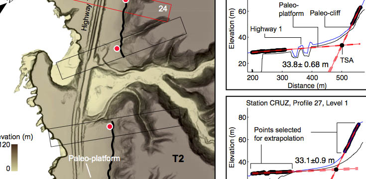
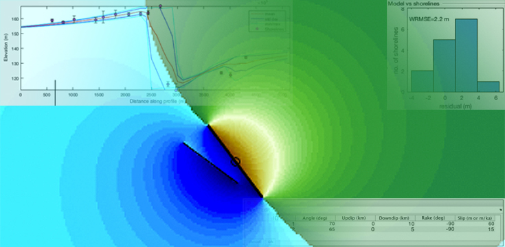
Since decades, cryptic faults have concerned earthquake scientists because of their unexpected presence. Unlike typical faults, cryptic faults pose a hidden seismic potential that is hard to identify before they produce an earthquake. The recent rupture of previously unknown faults such as the 2019 Ridgecrest in California, 2016 Papatea fault in New Zealand and several others highlight the high potential of cryptic fault to produce damaging earthquakes as well as a current gap in our understanding of cryptic faults. Here we developed a novel approach to detect these hidden faults and estimate their seismic potential by studying off-fault deformed geomorphic markers such as marine terraces using TerraceM and 1-metre resolution LiDAR topography, optical dating of sediments and space geodetic observations. We further used the TerraceM dislocation model to estimate the fault slip rate and their seismic potential.
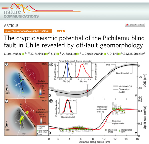
The approach proposed in this study opens new opportunities for the development of more accurate active-fault maps and hazard assessments, with far-reaching implications for seismic risk management in coastal areas.