Search
Feeds
Archives
About
Links
TerraceM in Nature Geosciences
Tuesday 29 March 2016 at 7:18 pm.A new publication in Nature Geosciences about earthquake deformation and coastal uplift in northen Chile using TerraceM mapping methods in rasas or reoccupied marine terraces coupled with a landscape evolution model. This paper proposes an new perspective of accumulation of permanent deformation in the upper crust through supercycle deep events. Codes and GUI will be avaliable soon.
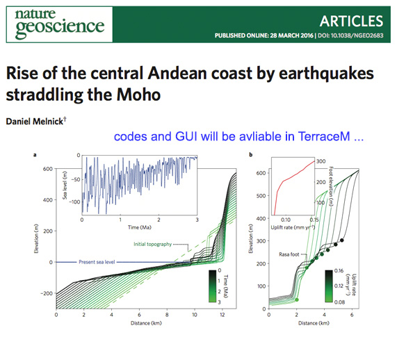
Examples of rasa analysis in Northern Chile (Melnick 2016. Nature Geosciences)
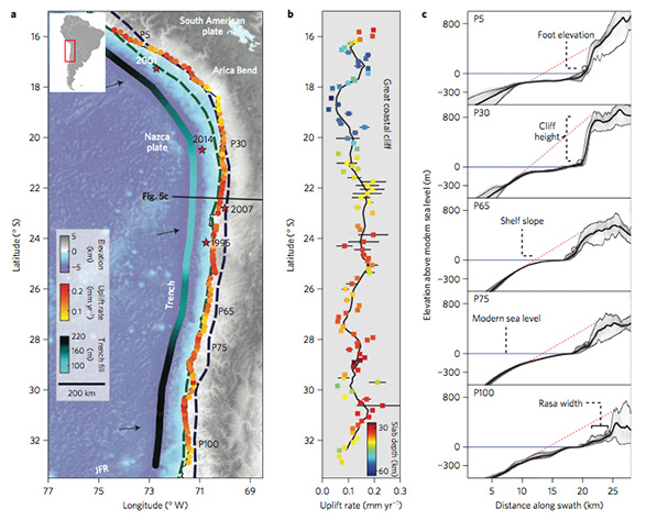
Melnick’s assessment of continental- scale uplift, employing an elegant landscape model that accounts for erosion caused by oscillating sea levels, and subduction zone seismicity in Chile implies that over geological timescales the coastline gradually uplifts in response to earthquakes on the deep subduction plate boundary. This counterintuitive result invites careful reappraisal of where and how megathrust strain energy is accrued and spent and the role of deeper deformation processes across the earthquake cycle of subduction zones. Aligned swath profiles based in TerraceM mapping methods were used to determine permanent deformation rates.
