Contiental-scale marine terrace mapping along southamerica
Thursday 23 November 2023 kl. 18:55
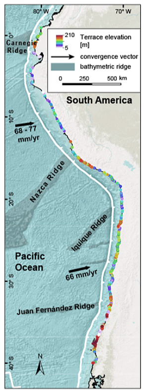
Roland Freisleben has presented a monumental marine terrace mapping along the western coast of southamerica along 6.000 kms. This titanic progress was done using TerraceM-2 and Tandem-X topography. The marine terraces of the las interglacial (MIS 5e, 125 ka) are present almost continously along the coast and in most cases carved in bedrock. The systematic mapping by Freisleben et al. (2021) provides for first time an almost continous assesment of vertical deformation rates since 125 ka. Using statistical methods and wave theory he disentangled the frequency and amplitude of permanent deformation patters along the coast, this allowed to discriminate between the wavelenght of different deformation mechanisms and their role in tectonic uplift distribution and megaearthquake segmentation (Freisleben et al. 2023).