Search
Feeds
Archives
About
Links
Morphometric Analysis to Assess Sea level History and Uplift Rate in the Pleistocene Marine Terraces of Chabahar (Iran)
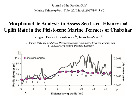
Friday 19 August 2022 at 6:49 pm.Marine terraces are strain markers that can provide crucial information to asses past sea-level changes in tectonically active coastal realms such as in the Chabahar Peninsula, Iran. Here TerraceM was used to accurately measure the elevation of marine terraces to elucidate their pattern of deformation along the strike. The TerraceM analysis allowed us to elucidate the location of active normal faults and their seismic potential.

