Search
Feeds
Archives
About
Links
Variable Quaternary Uplift Along the Southern Margin of the Central Anatolian Plateau Inferred From Modeling Marine Terrace Sequences
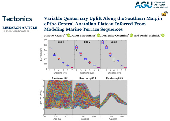
Sunday 19 June 2022 at 7:02 pm.The southern margin of the Central Anatolian Plateau (CAP) records a strong uplift phase after the early Middle Pleistocene, which has been related to the slab break‐off of the subducting Arabian
plate beneath the Anatolian microplate. We used the TerraceM software to map the position and elevation of associated shoreline angles. Then we used the TerraceM Landscape Evolution Model that simulates wave erosion of an uplifting coast. Using random optimization algorithms and minimization statistics we find the input parameters that better reproduce the morphology of CAP marine terraces. The best‐fitting uplift rate history suggests a significative increase from 1.9 to 3.5 m/kyr between 500 and 200 kyr, followed by an abrupt decrease to 1.4 m/kyr until the present, which agree with slab break‐off models.

