Search
Feeds
Archives
About
Links
Estimating Holocene fault activity using marine terraces in Central Chile
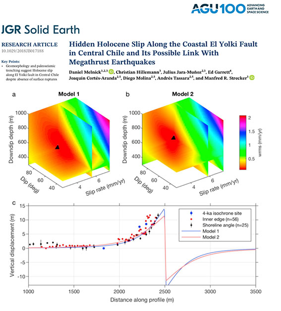
Thursday 25 July 2019 at 07:32 am.We studied the El Yolki fault (EYOF), a transtensional structure midways the Maule rupture not triggered in 2010. We mapped a Holocene coastal plain using light detection and ranging, which did not reveal surface ruptures. However, after mapping marine terraces with TerraceM we determined 10 m of vertical displacement. These deformed markers imply ~2‐mm/year throw rate, and dislocation models a slip rate of 5.6 mm/year for the EYOF. This works higlight the importance of accurate TerraceM assements of Holocene marine terraces to estimate fault slip rates and recurrence time.

No comments
