Search
Feeds
Archives
About
Links
TerraceM application to drowned marine terraces in Central Chile
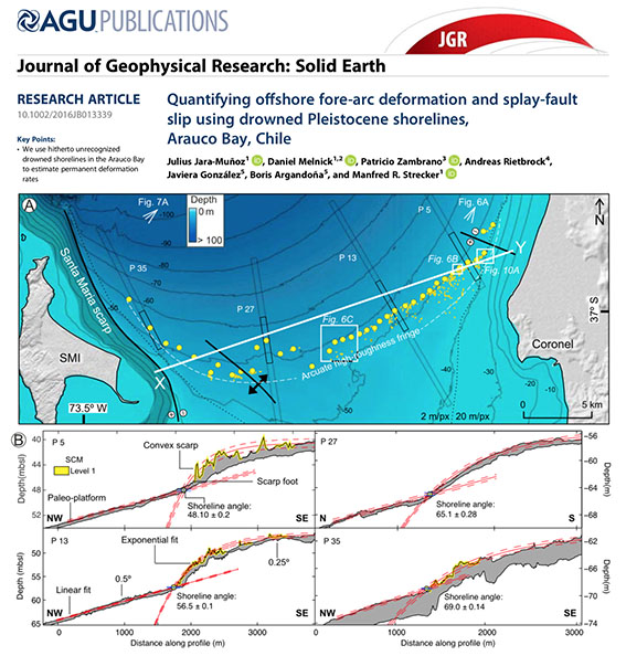
Thursday 25 July 2019 at 07:11 am.Submarine or drowned marine terraces may provide crucial information about deformation rates in areas that usually lack of surface deformation rate estimates. Here we present a recent study of drowned marine terraces in the Arauco Bay and the nearby Santa Maria island, an area that includes the Santa Maria fault system, a structure characterized by surface ruptures and associated coastal uplift during the 2010 Maule earthaquake (Mw 8.8). In this work we used the depth patterns of marine terraces and elastic dislocation models to estimate the slip rate of the Santa Maria Fault and their earthquake recurrence at glacial cycle time-scales.

No comments
