Search
Feeds
Archives
About
Links
TerraceM-2
Wednesday 22 April 2020 at 5:35 pm.The new TerraceM-2 version include modelling analysis and mapping routines to performe comprehensive analyses of marine terraces. This work was published in December 2019 in Frontiers in Earth Sciences, and is available for download in this site.
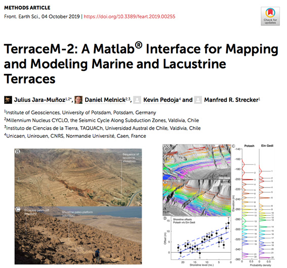
1) Improved mapping interface based in swath profiles, include also a Surface Classification Model interface to semiautomatically map marine terrace surfaces using slope and roughness
2) Analysis tools, such as uplift rate calculator, using diverse methods, projection of results along customized profiles, the world marine terraces database of Pedoja et al. (2014) for quick comparison and many other tools...
3) Numerical modelling routines, include a Landscape Evolution Model, and Elastic Dislocation Model to estimate the age of the terrace levels, model the hydrodynamic conditions during their development and variable or constant uplift rate conditions. Dislocation models allows determining fault slip rates from deformed marine terrace sequences.
